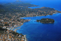
The island of Ugljan (52 km²/20 mi² and 75 km/46,6 mi of irregular coastline) lies just opposite of Zadar divided only by several nautical miles of the Zadar Canal. It is covered with evergreen pine forests, macchia, fig trees, vineyards and olive trees. For generations it has been connected with the sea through sailing and fishing, while its 2000 years of experience in olive growing has left hundreds of thousands of olive trees from which we get oil of exceptional quality and flavour. The entire north-eastern side of island contains a series of natural coves full of fishing and tourist sites among which the best known are Kukuljica, Kali, Preko and Ugljan. The other side of the island is generally steep and uninhabited but with nice coves, islands and rich underwater life, offering a real challenge for divers and anglers. Coves Velika, Mala Lamjana and Sabuša in the southwest are especially attractive. Although the island is rocky, it has many paths suitable for walking and cycling tours.
Mediterranean landscape lovers can enjoy the unforgettable views. Hands down, the most impressive view is of the Venetian fortress of St. Michael (13th century). Roman ruins, old Croatian churches, monasteries, stone island architecture and numerous villas showcase Croatia’s rich history. With more than 2500 sun hours annually plus stone and sand beaches, crystal clear sea, different possibilities of accommodation, unique culinary experience and good ferry connections with cities Zadar and Biograd the island is an exceptional place to visit.
The Town of Preko

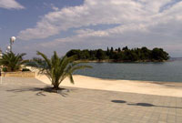
The little town of Preko is situated in the central part of the island of Ugljan which is opposite Zadar, with old parts of the typical Dalmatian architecture and many country houses of patrician families. The best way to feel the Mediterranean atmosphere is by strolling along the "waterfront view" or sipping your favourite drink in one of the restaurants and cafés overlooking the city harbour. Preko town is the nearest point of departure for a trip to St. Michael (265 m/869,4 ft above the sea level) reached from a 3km/1,86 mi long asphalt road. From the fortress there is a magnificent view of more than 200 islands of the Kornati archipelago and the Kornati national park. Only 80 m/262,4 ft away from the centre lies idyllic Galevac island (Školjić), covered with lush Mediterranean vegetation and concealing a unique Franciscan monastery from the 15th century. The monastery and nearby Jaz cove are favourite spots for swimmers. In the eastern part of town near the ferry pier there is a Romanesque church of St. John from the 11th century.